

This content has been automatically translated from Ukrainian.
The word "Donbas" sounds as if it belongs to ancient geographical names — like Polissia, Podillia, or Volyn. In reality, it emerged relatively recently and initially referred not to a historical land or an administrative unit, but to a region of mineral deposits. The name was created by geology, spread by industry, and the familiar meaning it has today was only acquired in the 20th century.
The history of this word shows how the discovery of coal seams, the emergence of mines, metallurgical plants, and railways can not only change the landscape but literally give a territory a new name.
Did the region have an ancient name?
Until the 19th century, there was no single established name for the entire territory of modern Donetsk and Luhansk regions. These lands did not form a separate historical region with clear and unchanging borders.
In ancient times, they were part of a vast steppe area through which various nomadic peoples passed and settled. In the Middle Ages, the Black Sea and Azov steppes were part of much larger territories known as the Polovtsian land or Desht-i-Kipchak — "Kipchak steppe." However, none of these names referred solely to the future Donbas.
From the 15th century, the concept of Wild Field spread in sources. This referred to a vast steppe strip that extended far beyond the modern territories of Donetsk and Luhansk. The word "wild" did not mean completely empty or uninhabited. Here, people roamed, hunted, grazed livestock, fished, mined salt, and established trade routes. However, due to constant military danger, the network of permanent settlements remained relatively sparse.
In the 16th to 18th centuries, different parts of the future industrial region belonged to several historical zones. A significant part of northern modern Luhansk and a small part of northern Donetsk were part of Slobidska Ukraine. The central and southern lands were associated with Zaporizhzhia, particularly with the Kalmius regiment of the Zaporozhian Cossacks. To the east were the lands of the Don Cossacks, and the Nadazov region had its own history of settlement, an important part of which was the Greek community.
Thus, the phrase "Donbas in the 17th century" is conditional. The Donbas as a separate region did not yet exist, and the lands that would later be called so had different historical affiliations.
Where did the word "Donetsky" come from?
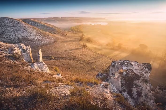
The basis of the future name was Siversky Donets — the largest tributary of the Don. It is from the name of this river that the adjective "donetsky" was formed in the phrases "Donetsky ridge" and "Donetsky basin."
The designation "Siversky" is associated with the Sivers and Siverska land, near which the river's headwaters are located. The form "Donets" is related to the name of the Don and contains a diminutive suffix. In different historical periods, the names Don and Donets could refer to separate parts of the river system, so the explanation "Donets — little Don" conveys only the general linguistic logic, but not the entire complex history of the hydronym.
Importantly, Donbas was not named after the city of Donetsk. The sequence was the opposite: first, the names Donetsky ridge and Donetsky basin appeared, then the shortened word "Donbas," and only in 1961 was the city of Stalino renamed Donetsk.
Donetsky ridge and the research of Yevgraf Kovalevsky
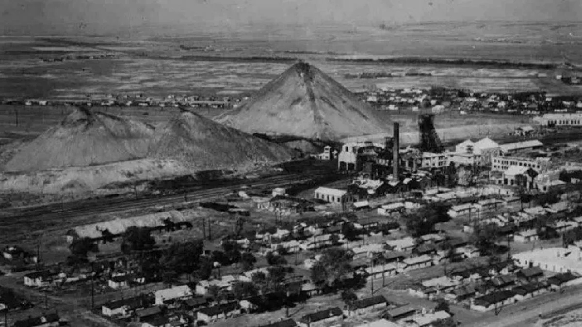
Coal deposits in this region were known long before the name "Donbas" appeared. They were explored as early as the 18th century, and in 1795 the first industrial mine was established in Lysychansk, on the territory of modern Lysychansk. The following year, it began supplying coal to the Luhansk foundry.
However, individual mines did not yet form a cohesive industrial region. To develop it, it was necessary to determine how coal seams lay, their extent, and whether they constituted a single geological system.
An important role in this was played by mining engineer and geologist Yevgraf Kovalevsky, a native of Kharkiv region. In 1827, he was sent to inspect the Luhansk foundry. While studying the surrounding area, Kovalevsky described its geological structure and introduced the term Donetsky ridge into scientific circulation, formed from the name of the Siversky Donets.
In his work "Geognostic Review of the Donetsk Mountain Ridge," published in 1829, he provided one of the first systematic descriptions of the local coal seams and a scheme of their location. Later, the term "Donetsky ridge," which primarily referred to the form of relief and geological structure of the elevation, was supplemented by the broader name — Donetsk coal basin.
In geology, a basin is defined not only as the area from which water drains into one river. It is also a region of certain rocks or mineral deposits. The Donetsk coal basin is a large geological structure within which interconnected deposits of coal are located.
How the Donetsk basin became Donbas
The word Donbas originated as a shortening of the name Donetsk coal basin, or more precisely — its shorter form Donetsk basin:
Donetsk + basein = Donbas.
In a similar way, the names "Kryvbas" — Kryvyi Rih iron ore basin — and "Kuzbas" — Kuznetsk coal basin — were formed.
Initially, the term belonged mainly to professional and economic vocabulary. It was used by geologists, mining engineers, mine owners, industrialists, and railway workers. Throughout the 19th century, the full name "Donetsk basin" occurred much more frequently, while the shortened form gradually entered wider usage.
The public and political use of the word "Donbas" became particularly noticeable at the beginning of the 20th century. For example, in political speeches of 1917, it already sounded as a name for the coal-industrial region understood by a broad audience. However, it is difficult to establish one exact date when the abbreviation first appeared in speech: initially, it may have existed in business and professional circles before entering the press and political vocabulary.
How industry united different lands
The true formation of Donbas as a separate region began in the second half of the 19th century. It was then that the volumes of coal extraction rapidly grew, metallurgical plants were built, railways were laid, and new worker settlements emerged.
Industry created connections that did not previously exist. Mines supplied fuel to factories, metallurgical enterprises needed coal and iron ore, railways transported raw materials and finished products, and new cities attracted tens of thousands of workers. Territories with different previous histories gradually transformed into a single economic space.
At the same time, the Donetsk basin did not coincide with administrative borders. At the end of the 19th and the beginning of the 20th century, its enterprises were mainly located in the Bakhmut, Mariupol, and Slovianoserbsk districts of the Yekaterinoslav province, partially in the Kharkiv province and in neighboring districts of the Don Cossack region.
A person could officially reside in the Yekaterinoslav province but work in a mine of the Donetsk basin and refer to their workplace as Donbas. Therefore, this name initially described not an administrative unit but an industrial-economic region.
When did Donbas acquire administrative outlines?
In 1919, the Bolshevik authorities first attempted to unite the main industrial areas within the Donetsk province. Its initial composition and borders were soon revised, and in 1920, the Bakhmut, Mariupol, and Slovianoserbsk districts, the Starobilsk district, parts of the Izium and Kupiansk districts, as well as Taganrog and parts of neighboring districts were included in the province.
Initially, the center of the province was Luhansk, and from 1920, it was Bakhmut. The Donetsk province was supposed to unite mines, factories, railways, and surrounding agricultural areas into one economic system, but it existed only until 1925.
In 1932, a large Donetsk region was formed within the Ukrainian Socialist Soviet Republic, encompassing the territories of modern Donetsk and Luhansk regions. Initially, its administrative center was Artemivsk — modern Bakhmut, but by the fall of 1932, the regional institutions were moved to Stalino.
In June 1938, the Donetsk region was divided into Stalin and Voroshilovgrad. In 1961, the city of Stalino was renamed Donetsk, and Stalin region was renamed Donetsk. Voroshilovgrad region was called Luhansk from 1958 to 1970, then it returned to its previous name, and in 1990 it again became Luhansk.
Against the backdrop of numerous administrative reforms and renamings, the word "Donbas" turned out to be remarkably resilient. It was not tied to the name of a political figure or a specific system of territorial organization.
How the meaning of the word "Donbas" changed
Initially, Donbas referred specifically to the area of coal deposits and extraction. Its boundaries were defined by geological layers and the location of industrial enterprises, not by the borders of regions.
During the Soviet period, the meaning of the name began to expand. Donbas became one of the main symbols of industrialization: the press glorified the work of miners, local symbolism was formed around the coal industry, and cities and enterprises were presented as parts of one large industrial organism.
Gradually, Donbas came to refer not only to the mining strip but almost the entire territory of Donetsk and Luhansk regions. From a historical-geographical perspective, this generalization is not entirely accurate. The northern part of Luhansk largely belongs to Slobozhanshchyna, Nadazov has its own history, and part of the agricultural areas of both regions lies outside the main coal deposit zone.
In contrast, the geological Donetsk basin extends beyond Ukraine and stretches further east. Therefore, its territory also does not coincide with the modern political and media perception of Donbas as two regions of Ukraine.
In fact, the word has several meanings:
- geological — Donetsk coal basin;
- industrial — a network of mines, factories, and associated cities;
- historical-economic — a region formed by the industrialization of the 19th–20th centuries;
- socio-political — a widely used collective name for Donetsk and Luhansk regions.
Because of this, it is impossible to draw one universal map of Donbas. Its boundaries depend on what is being discussed: geology, industry, history, or modern political geography.
A name younger than the region itself
Donbas does not belong to historical regions whose names have continuously existed for many centuries. It is a relatively young industrial region that formed mainly in the 19th–20th centuries.
Before the emergence of large coal and metallurgical industries, its lands did not constitute a single whole. Some gravitated towards Slobozhanshchyna, others were connected with Zaporizhzhia, Nadazov, or the Don Cossack borderlands. Only geological research revealed a common system of coal seams beneath them, and mines, factories, railways, and worker cities transformed this geological unity into economic and social.
Thus, on the map, the Donetsky ridge, Donetsk coal basin, industrial Donbas, Donetsk province, and large Donetsk region appeared sequentially. The meaning of the name expanded along with the region itself: from a geological term to a word that began to denote a territory, industrial culture, and a separate regional identity.